|
|
|
|
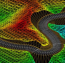
Digital Terrain Modelling
CivilTerrain is designed to be independent of the CAD package you use. It offers fast triangulation capabilities and is able to model an unlimited number of ground control points. You can load your OGL control points from text files, GIS Shapefiles, CSV files, DXF files or LandXML files.
The software allows you to define your own breaklines and extract level and long section information from the DTM. Define earthworks terraces, ponds, opencast mining models and generate toe lines and contours from the DTM.
The DTM is used in other modules of CivilTerrain, for example for road and pipe design purposes. CivilTerrain will use the DTM to generate long sections along the road center line, or for you to determine you pipe long sections' ground level data.
Click here to download your free copy of CivilTerrain. |

|
|
|
|