|
|
|
|
Road Design
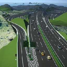
You can use CivilTerrain to design single and dual-carriageway roads. You can draw the road's points of intersection (PIs) in our graphical user interface. For each PI, you can define a curve radius and optionally transition curve lengths. CivilTerrain will use the Digital Terrain Model to calculate the original ground level (OGL) along the road centerline that you defined, and you can use that to determine the long section of the road, with vertical curve lengths and sight distance calculation. You can download setting out information and coordinates as a spreadsheet.
Once you have defined the road centerline and road vertical alignment, you can define road cross-section data, including lanes, superelevation and layerworks definitions. Using the road cross-section data, CivilTerrain will allow you to view the cross-section at any chainage. Once your cross-section design is complete, you can download the earthworks quantities for your road and CivilTerrain will also generate a Mass Haul Diagram for your road.
CivilTerrain can export your road design to a DXF file, to allow you to use the road designs in the CAD package of your choice.
Click here to download your free copy of CivilTerrain. |

|
|
|
|